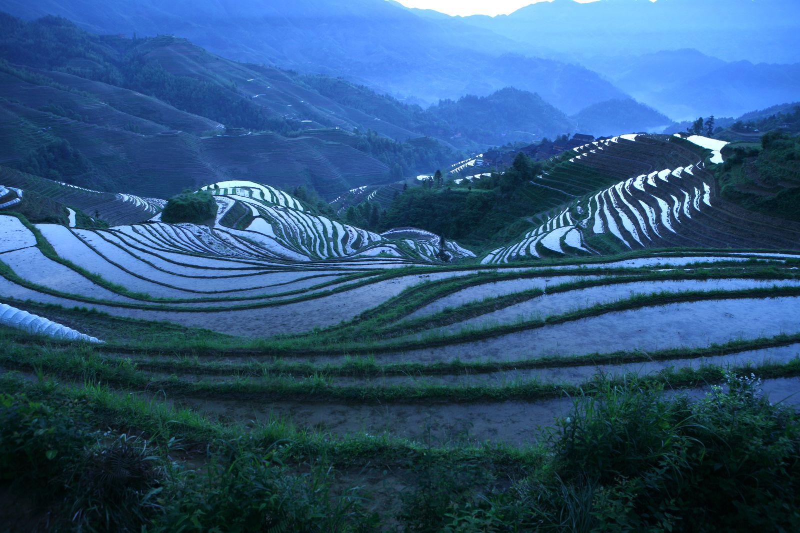
The Loess Plateau covers some 640,000 square kilometres of north-central China — an area comparable to France — and for most of the twentieth century it shed soil into the Yellow River at roughly 1.6 billion tonnes a year. The mechanism that stopped it is a layered one: bench terraces, gully check dams and replanted slopes, accelerated after 1999 by a state programme called Grain for Green that paid farmers in grain and cash to take steep cropland out of cultivation. Annual sediment load leaving the plateau has fallen to roughly 0.2 billion tonnes, and vegetation cover has roughly doubled. The soil stayed. The river cleared.
One honest complication belongs here rather than buried later. The turn did not begin in 1999. Soil conservation on the plateau dates to the 1970s, and check dams built between 1970 and 2020 intercepted on the order of 10 billion tonnes of sediment on their own. Grain for Green accelerated and industrialised work already underway — which is why the sediment curve bends decades before the programme was named.
Why the plateau bled in the first place
Loess is wind-blown silt, deposited over roughly 2.6 million years by dust storms sweeping off the Gobi and the Mongolian steppe. It piles up in beds 100 to 300 metres thick in places, which is why the plateau’s canyons look like sliced layer cake. The particles are fine, angular, and only loosely bonded. Dry loess will hold a vertical cliff. Wet loess collapses into slurry.
For most of the Holocene, a cover of temperate forest and grassland kept the silt in place. Then came the plough. Han-dynasty expansion, Ming-era resettlement, and twentieth-century population pressure stripped the canopy until the plateau was classified as suffering severe erosion across much of its area. Every summer thunderstorm carved fresh gullies. Fields slid downhill.
The Yellow River, fed by this runoff, deposited so much sediment on its own bed downstream that in places it flows above the surrounding farmland, held in by dykes. A perched river is a slow emergency: the bed rises, the dykes rise to match, and the consequences of a breach rise with them.
The 1.6 billion tonne number, and where it went
That 1.6 billion tonne annual figure is a mid-twentieth-century average measured at gauging stations on the middle Yellow River, including Tongguan. It is not a modelled estimate but a reading taken off the water, year after year, by people whose job was to weigh a river.
Most of that silt did not reach the sea. It settled on the riverbed, on the floodplain, and — over centuries — built the Yellow River delta itself, a lobe of new land in Shandong province that grew rapidly through the period of peak sediment delivery.
The delta city of Dongying sits on that accumulation, roughly 1,000 kilometres downstream of the plateau that supplied it. Its ground is the Loess Plateau, relocated by water.
What the terraces, dams and trees actually did
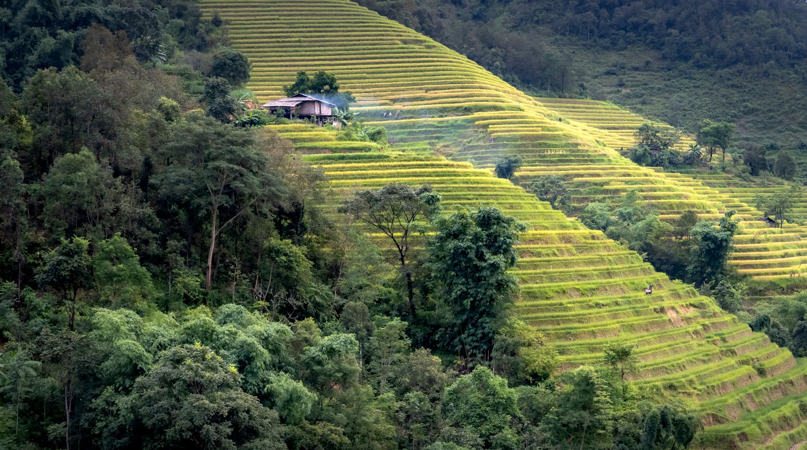
The intervention had three physical tools. First, bench terraces: horizontal steps cut into slopes, each terrace a metre or two high, with a flat tread wide enough to plough. Rainwater that once sluiced downhill in sheets now pools on each tread and soaks in. Second, revegetation of steeper ground with drought-tolerant species — sea buckthorn, black locust, Caragana shrubs — planted in pits dug on contour. Third, check dams: earthen or concrete barriers strung across gully bottoms to catch sediment before it reached the main river.
Check dams have been remarkably effective. A 2022 study in Frontiers in Environmental Science examined the Hekou–Longmen region and its 17 tributaries — the stretch of the middle Yellow River that historically produced most of the sediment — and separated the decline into distinct phases: a baseline period, a period driven mainly by check dam construction, and a later period in which check dams and vegetation restoration worked together. By the end of 2011 the region held 3,786 key check dams.
The tributary-scale picture is the same. Modelling published in Scientific Reports in 2025 on the Xiliugou basin in the Inner Mongolia section found that 79 newly built check dams cut average annual water yield by about 2.44 million cubic metres and sand transport by about 409,000 tonnes — intercepting both before either could enter the main channel.
At basin scale, a 2025 review in Nature Reviews Earth & Environment traced changes in water cycling and sediment loads across the Yellow River basin since the 1950s, attributing them to land-use transformation, water withdrawals, reservoir operation and conservation works rather than any single cause. The pattern is consistent at every scale examined. Sediment yield collapsed. Runoff dropped too, which turned out to matter for a different reason.
Less water leaves the plateau because more of it soaks into terraced ground and into the roots of new trees. That has knock-on effects downstream, and they are not all straightforward gains.
A 2025 paper in Nature Communications modelled what restoration did to hydropower at the Xiaolangdi Reservoir, which controls 92.3 percent of the basin area. The finding is genuinely двусторонний: average annual energy generation actually fell about 6.9 percent, because there is less water. But the reservoir’s sediment storage now fills far more slowly, extending its working life — and over that longer lifespan it could generate roughly 57 percent more total energy than it would have without restoration. The gain is in duration, not in output per year.
Carbon, quietly, as a side effect
Soil that stays on a hillside keeps its organic carbon. Soil that washes into a river and buries itself in a delta loses much of that carbon on the way. A 2018 paper in Scientific Reports by Lishan Ran and colleagues reported the magnitude of carbon stabilisation associated with erosion control across an entire large river basin — the first such accounting for the Yellow River.
The same paper is careful about the timing, and so should we be. The plateau ecosystem was a net carbon source through the 1970–1999 interval, and the balance was still negative in 2000, a year after Grain for Green began. The flip came later. That paper also records the vegetation figure most often quoted loosely: cover rose from 31.6 percent in 1999 to 59.6 percent in 2013, reaching about 63.6 percent by 2019.
Which connects the story to a beat Moon Daily has followed elsewhere. Restoration timelines are almost never fast. Blocking drainage canals in tropical peatlands took nearly two decades to show measurable results. The plateau moved faster because part of the intervention was mechanical — cut a terrace, water pools that afternoon — layered on top of the slower biological work of getting roots into the ground.
The generation who did the digging
Grain for Green enrolled millions of rural households. Farmers were paid in grain rations and cash subsidies to take the steepest fields out of cultivation for a fixed period. Enforcement was uneven. Some replanted slopes were cleared again when subsidies expired.
But the terraces, once cut, stayed cut. Bench terraces are self-reinforcing: each one traps its own sediment on the tread above, so the structure thickens rather than degrades. A subsidy can lapse. A step cut into a hillside does not.
The scale of the earthworks is easy to miss from ground level and obvious from orbit. Landsat and Sentinel-2 imagery from the mid-2010s onward shows the plateau in horizontal stripes — contour lines where vertical furrows used to run.
The comparison to other national-scale restoration efforts is instructive. South Korea’s post-war reforestation took roughly seven decades to move national forest cover from 35 percent to two-thirds. Bangladesh’s cyclone protection network took 50 years to bring storm mortality down by more than 99 percent.
What the river looks like now
Holding the soil has costs. Water that used to run off the plateau now stays there, and groundwater tables in some sub-basins have dropped as trees transpire what rain delivers. Sea buckthorn and black locust are hardy but thirsty, and monoculture plantations do not carry the biodiversity of the temperate forest the plateau lost.
In the delta, the balance has flipped the other way. Having accreted rapidly for most of the twentieth century, the subaerial delta transitioned to an erosional state after 2000 as sediment supply fell — the Bohai Sea’s waves now rework the shoreline faster than the river rebuilds it.
Dongying, the boomtown built on silt, felt that first. China Daily reported in 2019 that in the mid-1990s the river dried up for about 100 days a year on average, estuary wetlands shrank sharply and large numbers of birds and fish died. Conditions began to turn in 2002, when the Yellow River Conservancy Commission started using the Xiaolangdi project — completed in 2001 — to store floodwater and release it in dry seasons. Dykes were built in the estuary wetland, and some 23,333 hectares of degraded wetland have been restored since.
The plateau intervention is unusual in restoration ecology because the results arrived inside the working lifetime of the people who built it. A farmer who cut her first terrace in 1999 at age 30 is 57 in 2026, and the river she grew up watching run yellow carries a fraction of the load it did in her childhood.
Stand on the bridge at Tongguan, where the Wei River meets the Yellow, and the water is still tinged brown after summer rains. It has not become clear. The plateau still delivers sediment in wet seasons, and the delta still gains in some years and loses in others depending on what Xiaolangdi releases. But the hillsides above the river no longer collapse into slurry after every storm. The vertical furrows that generations ploughed into slopes too steep to hold have been recut into horizontal steps that catch their own rain. The plateau, which spent four thousand years losing itself downstream, is finally staying where the wind put it.